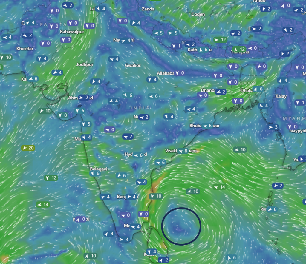
A low-pressure system currently located about 400 km southeast of Chennai is moving west-northwestwards. This movement is expected to continue for the next 24-48 hours. However, the system is not directly hitting Tamil Nadu or Andhra Pradesh, as an interesting twist lies ahead.
U-Turn and Coastal Journey
After nearing the north Tamil Nadu coast, the system is likely to take a U-turn. It is then expected to travel along the coasts of Andhra Pradesh, Odisha, and West Bengal between December 19th and 22nd. This unusual movement will be crucial in determining the rainfall intensity and affected regions.
Rainfall Outlook
- For the next 24 hours, rainfall intensity will remain light to moderate as the system continues its west-northwestward journey.
- Once it reaches near the north Tamil Nadu coast, its movement and proximity to the coast will play a key role in intensifying rainfall.
- For Next 24 hours, North Costal of Tamil Nadu, Coastal of Andhra Pradesh will see Light to Moderate rains
Farmers’ Advisory
Farmers across coastal Andhra Pradesh, Odisha, and West Bengal are advised to harvest and store their crops promptly. This precaution is crucial to avoid crop loss due to unexpected rains during the system’s passage.
Stay tuned for further timely updates on this system’s movement, rainfall patterns, and impacts. As always, accurate tracking is essential, and I’ll continue to provide insights until the system weakens completely.