Under the influence of a depression in the west-central Bay of Bengal, moderate to heavy rains have lashed the Uttar Andhra region over the past three days. Key districts such as Visakhapatnam, Vizianagaram, and Srikakulam recorded significant rainfall, with some locations receiving around 80-120 mm.
However, the depression is now shifting its trajectory towards the northeast, influenced by a western disturbance. As a result, the intensity of rainfall over North Andhra Pradesh, including the Visakhapatnam belt, is expected to decrease from today onward. The system will likely remain over open seas for the next 24-48 hours, maintaining its strength temporarily.
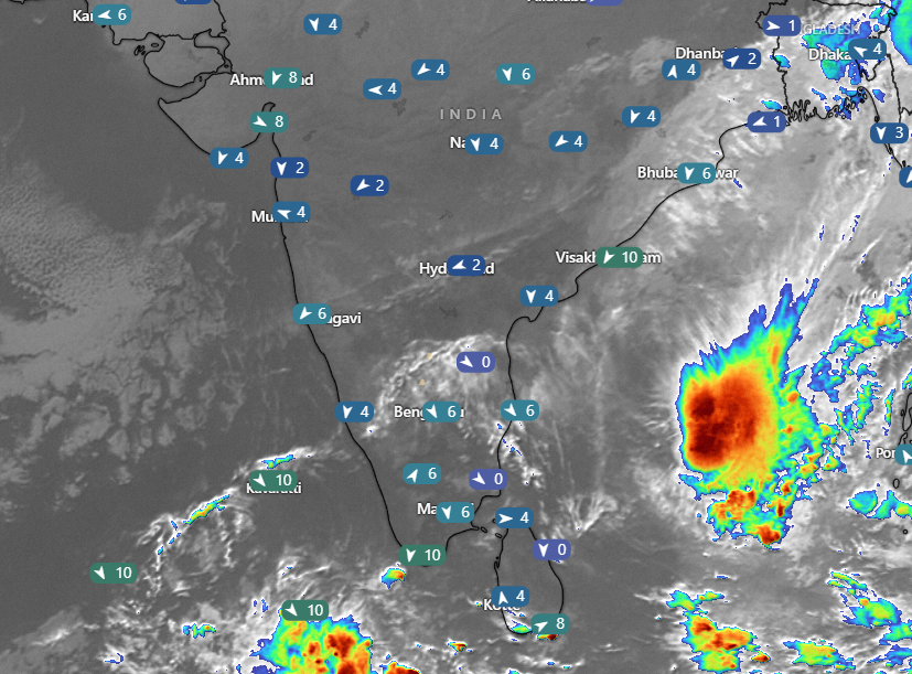
Current satellite images on 21st December 2024
Expected Changes in System Movement
Post-December 23, the depression is forecast to weaken gradually and begin drifting southwest towards the northern Tamil Nadu and southern Andhra Pradesh coasts. By the time it approaches the coast, it may transition into a cyclonic circulation or a trough.
This development could bring back rains to the coastal regions of Andhra Pradesh and Tamil Nadu around December 23-27, coinciding with the Christmas festivities. While the exact intensity and spread of these rains remain uncertain, residents along the coast should stay updated as the system evolves.
Conclusion
The current depression underscores the ever-changing nature of weather patterns during this time of year. As it continues to weaken and shift direction, its impact on coastal regions warrants close monitoring. Further updates on the system’s movement and intensity will be provided in the coming days. Stay prepared and enjoy a safe holiday season amidst the beauty of winter rains! 🌧️